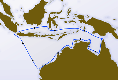
In August 1642, VOC despatched Abel Tasman and Franchoijs Visscher on a voyage of which one of the objects was to obtain knowledge of “all the totally unknown provinces of the kingdom of Beach”. This expedition used two small ships, the Heemskerck and the Zeehaen. Starting in Mauritius both ships left on 8 October using the Roaring Forties to sail east as fast as possible.
On 7 November, because of snow and hail the ships’ course was altered to a more north-eastern direction. On 24 November 1642 Abel Tasman sighted the west coast of Tasmania, north of Macquarie Harbour. He named his discovery Van Diemen’s Land after Antonio van Diemen, Governor-General of the Dutch East Indies. Proceeding south he skirted the southern end of Tasmania and turned north-east, Tasman then tried to work his two ships into Adventure Bay on the east coast of South Bruny Island where he was blown out to sea by a storm, this area he named Storm Bay.
On 7 November, because of snow and hail the ships’ course was altered to a more north-eastern direction. On 24 November 1642 Abel Tasman sighted the west coast of Tasmania, north of Macquarie Harbour.[31] He named his discovery Van Diemen’s Land after Antonio van Diemen, Governor-General of the Dutch East Indies. Proceeding south he skirted the southern end of Tasmania and turned north-east, Tasman then tried to work his two ships into Adventure Bay on the east coast of South Bruny Island where he was blown out to sea by a storm, this area he named Storm Bay. Two days later Tasman anchored to the north of Cape Frederick Hendrick just north of the Forestier Peninsula. Tasman then landed in Blackman Bay – in the larger Marion Bay. The next day, an attempt was made to land in North Bay; however, because the sea was too rough the carpenter swam through the surf and planted the Dutch flag in North Bay. Tasman then claimed formal possession of the land on 3 December 1642.
After some exploration, Tasman had intended to proceed in a northerly direction but as the wind was unfavourable he steered east. On 13 December 1642 they sighted land on the north-west coast of the South Island, New Zealand, becoming the first Europeans to sight New Zealand. Tasman named it Staten Landt “in honour of the States General” (Dutch parliament).
The expedition then sailed north, sighting Cook Strait, which it mistook for a bight and named “Zeehaen’s Bight”. Two names that the expedition gave to landmarks in the far north of New Zealand still endure: Cape Maria van Diemen and Three Kings Islands. Maria was the wife of his patron, Anthony van Diemen, Governor General of Batavia
Other images and maps
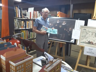
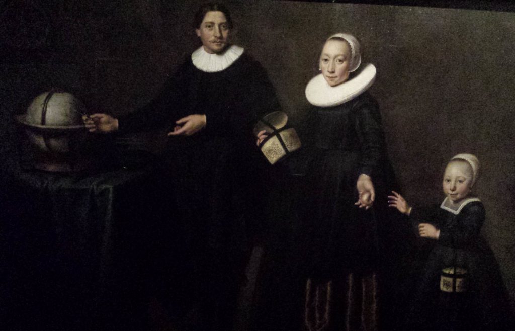
Lutjegast, near Groningen, is where Tasman was born in 1603. Shown a replica of the original painting of Tasman and his family. Bosman was on his way to Tasmania and then to New Zealand, in 2017, for the celebrations of 375 years following Tasman’s landings.
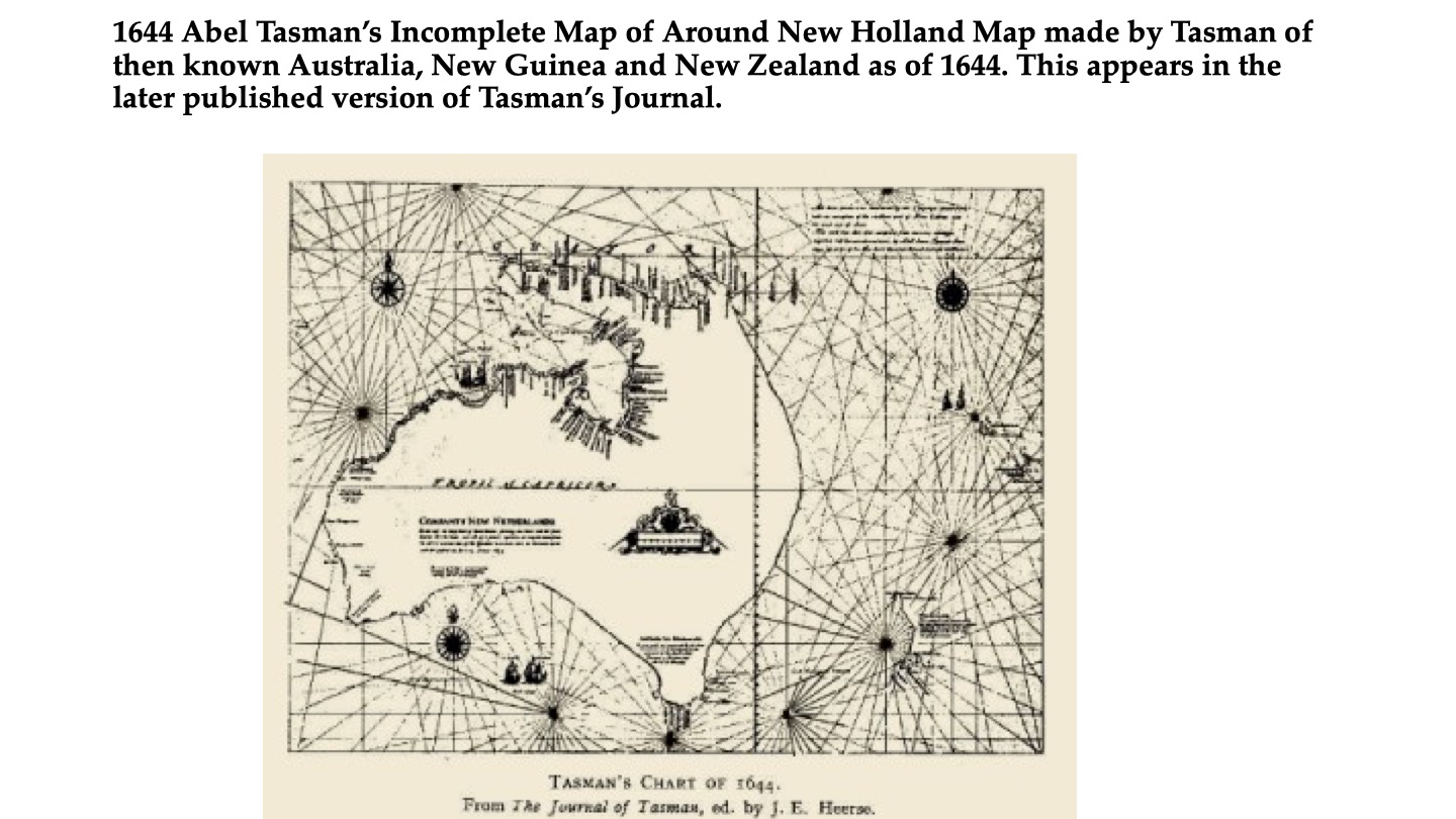
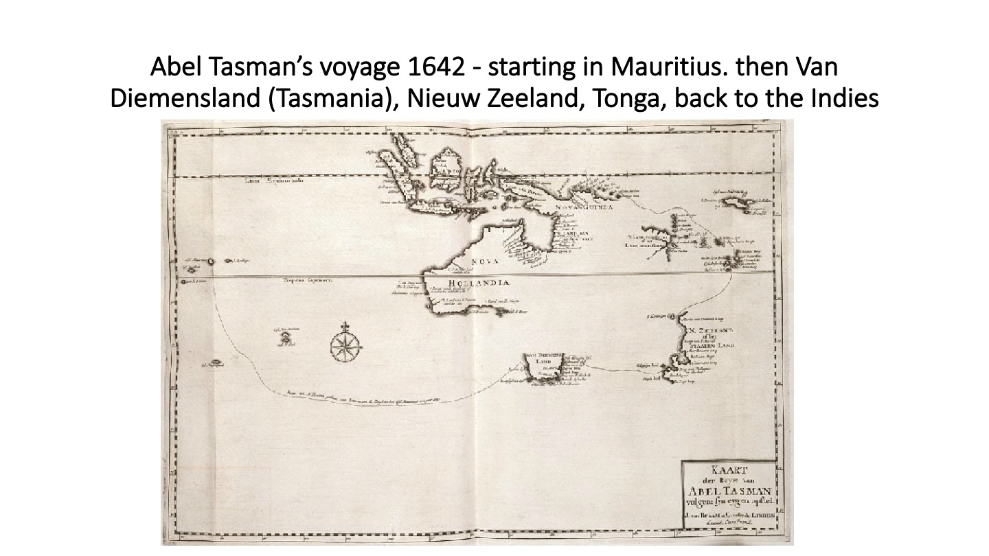
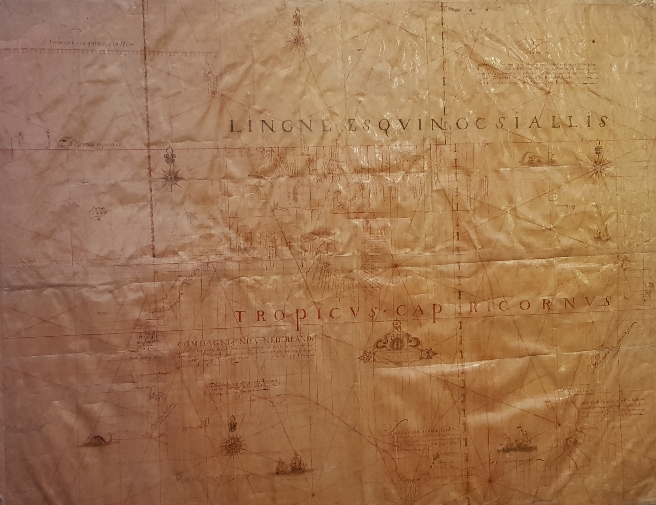
Abel Tasman Map Mitchell Library NSW Restored
